Fish Cages in Halong Bay
Halong Bay is a marine and island area located in the northeastern region of Vietnam, within Quang Ninh Province. Its coordinates range from 106°56’ to 107°37’ East longitude and from 20°43’ to 21°09’ North latitude.
- To the east, it borders Ngoc Vung Island, Cong Tay Island, and Bai Tu Long Bay.
- To the west, it borders Cat Ba Island and Hai Phong City.
- To the south, it borders the Gulf of Tonkin.
- To the north, it borders the mainland of Halong City.
Halong Bay covers an area of 1,553 km² and consists of 1,969 islands. The terrain includes islands and mountains interspersed with sea depressions, featuring steep limestone cliffs.
According to Decision No. 3981/QD-UB dated October 25, 2001, issued by the People’s Committee of Quang Ninh Province, seven areas in Halong Bay were approved for marine aquaculture using fish cages.
Currently, Halong Bay is home to over 250 fish farming rafts (floating houses with cages) located in four fishing villages: Cua Van, Ba Hang, Cong Vieng, and Cap Lai. While these fish farming rafts offer immediate benefits to local farmers and fishermen, their operations have increasingly caused serious environmental and scenic impacts on Halong Bay. If not addressed promptly, the pollution they cause could lead to unpredictable consequences for the bay’s ecosystem.
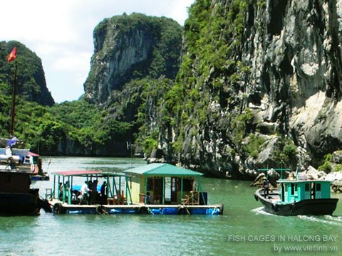
Below are several images of fish cage farming in Halong Bay, taken by Viet Linh during an aquaculture survey in Northern Vietnam.


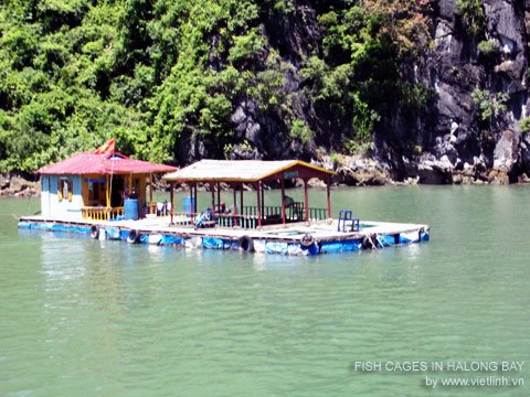


- Fish farming raft in Halong Bay. Photo: Viet Linh
- Cage farming next to limestone cliffs in Halong Bay. Photo: Viet Linh
- Aquaculture rafts in wind-sheltered areas of the bay. Photo: Viet Linh
- Raft farming in Halong Bay. Photo: Viet Linh
- A fish cage raft in Halong Bay. Photo: Viet Linh
- Fish cage raft and tourist boat in Halong Bay. Photo: Viet Linh
© Viet Linh. Ha Long, July 20, 2006